I am almost done with this Vietnam Map, 5 years in the remaking... oh my god 5 years... what have I done with my life?
Original post with screenshots:
https://www.sas1946.com/main/index.php/topic,66534.0.htmlI have remade every single town/village/airfield/city/port... etc. No objects from the original map by BB in 2010 are left aside from some of the roads and rails.
I deleted the almost 10,000 objects that were haphazardly thrown around the map in a copy paste format to replacing them with over 10,000 objects, sometimes copy pasted for the sake of sanity, but matching the terrain/textures/environment.
I have spent DAYS deleting/fixing roads so they go around mountains, not over, and fixing the weird artifacts left over.
I have not messed around with the rail system too much and don't care about it.
I have added new textures (taken from other maps by more talented people) and trees to break up the landscape to create the feeling of randomness.
I would like to finally release this in a couple months, but I'd like some help.
Enjoy the map, but keep an eye out for anything "weird" or out of place objects/trees/roads and let me know. I have played so many content creator maps that are fantastic, and *sigh* when I see some of these artifacts. Please post a screen shot and let me know the general location.
NOTE: Airfields are not to scale. The map is a lot smaller than actual South East Asia.
Link Posted 5 May 2024: https://www.mediafire.com/file/dw04zzb68ue5rke/NORTH+VIETNAM+GESCHIRR.zip/fileWorks on BAT 4.1.1 up to BAT 4.2.2 Hot Fix 4. Any other versions of IL-2 probably won't work.Thanks!
What I am looking to fix.
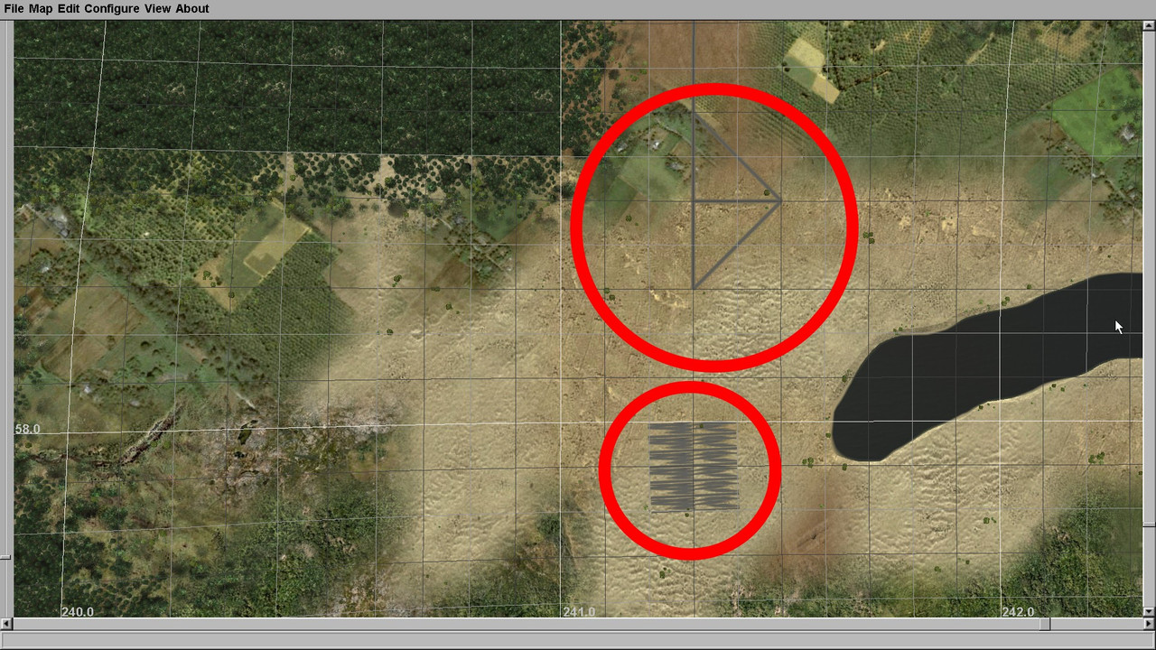
Random triangles and the square hatched artifact. I have fixed hundreds of these things, but I doubt I found them all.
NOTE: Triangles at intersections are okay, that is the only way I can make intersections of three or more roads work.
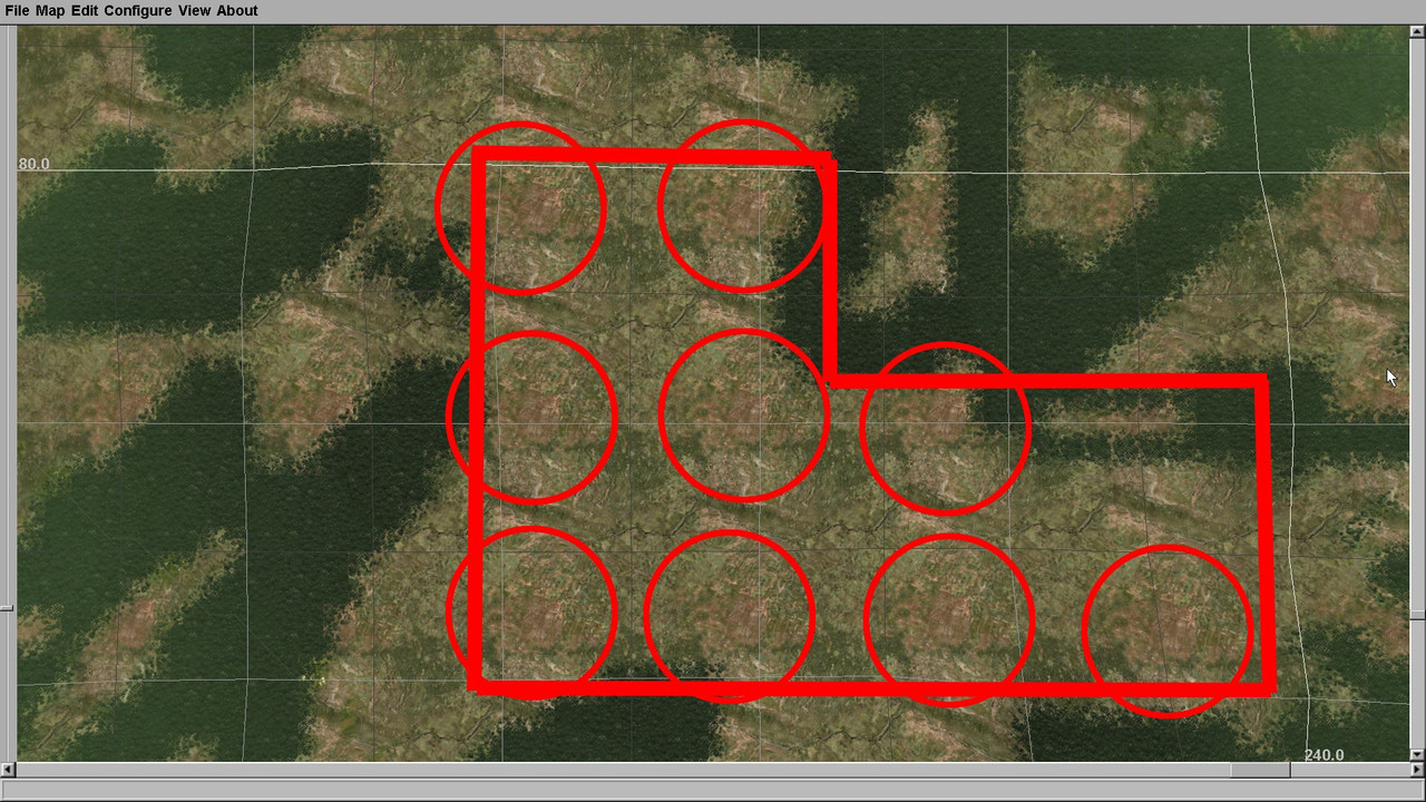
Repetitive landscapes. I solve this by just randomly drawing trees to cover up the obvious spots to create some randomness.
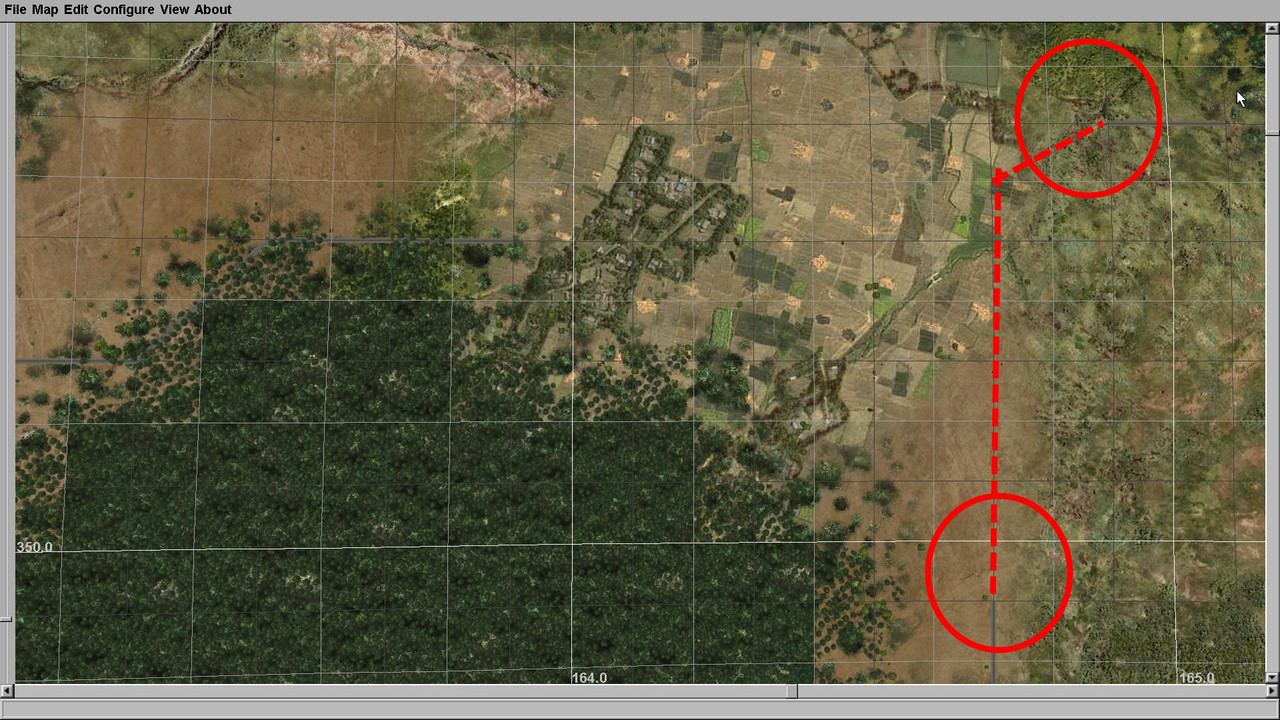
Missing roads not connecting.
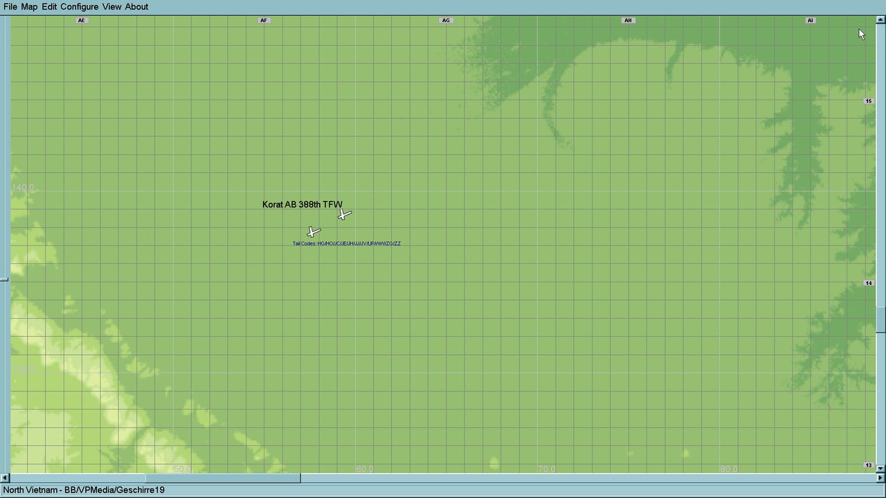
I also added info to each Air Base on the correct Tail Codes used by USAF aircraft. Does it clutter the map and make it hard to read?


 Author
Topic: NORTH VIETNAM - Geschirr Redux (Read 950 times)
Author
Topic: NORTH VIETNAM - Geschirr Redux (Read 950 times)