When reworking the street and rail net of the black sea map i found it usefully and also necessary to extract the roads and rails and also the towns and villages from the map_t.
For this i wrote a little tool, that creates from a map_t
a map_t.tga without roads and rails ("map_tNoRoadsNoRails.tga")
a TGA with white background with roads and rails alone ("map_t_RoadsAndRails.tga")
and a TGA with white background with the towns and villages alone ("map_t_Towns(Colours).tga).
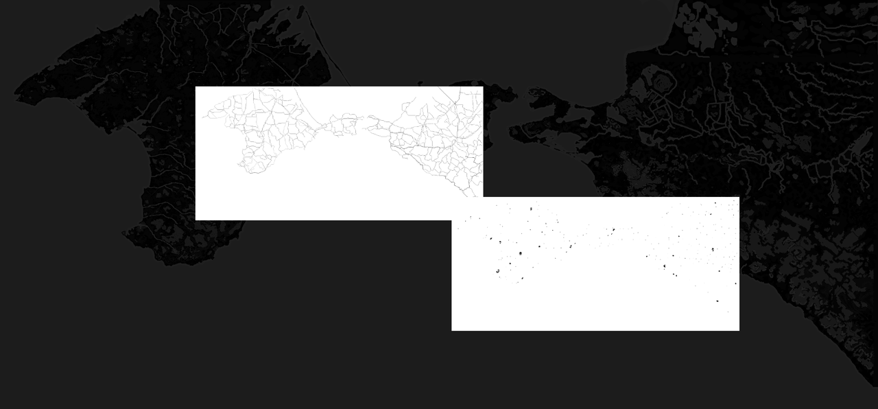
The road and town files used as layers and after adding transpareny joining them with the "add colours" feature of gimp to the pure map_t are usefull to create a new complete map_t and also the ed_m files.
Before extracting the towns and villages there is a prompt:"Type in colours of towns and villages separated with commas, then press Enter:". Type in then the colours of towns and villages according to the load.ini, for example: "14,15,17,18,19". The tool then will create a "map_t_Towns1415171819.tga".
Of course you also can extract any other colour of a map_t.
The tool also shows the length of the roads and rails. With the BlackSea map i found
4962 km of country roads
933 km of highways
and 1313 km of railroads.
You may download the tool here:
https://www.mediafire.com/file/bvr7wsopin92qzz/map_t_RoadAndTown_Extractor.7z/fileUsage: Throw the tool and the map_t.tga into the same folder. Run the tool. Type in the colours of the map_t to extract towns and villages (or other colours), separated with commas.
Novekat


 Author
Topic: Road, rail & town extractor (Read 2803 times)
Author
Topic: Road, rail & town extractor (Read 2803 times)